- Period
- 2016–2021
- Location
- Planning Regions 2, 7, 8 and 9, Rio Grande do Sul, Brazil
- Partners
- FAPERGS-funded research project (UFRGS, UNISC)
- My role
- From undergraduate research to PhD: data collection and organization, statistical and spatial analysis, maps, co-authoring articles and chapters, and co-editing an e-book.
- Data
- IBGE Census 2010 (commuting) · IBGE REGIC 2018 (urban hierarchy) · e-MEC and INEP (higher education) · Bus station schedules · Municipal data · Fieldwork
- Tools & methods
- QGIS · Excel · Adobe Illustrator · Flow mapping · Functional urban area delineation
The challenge#
Polycentrism, a territory organized around several complementary centers rather than one, is a goal of regional planning in Europe and increasingly in Brazil. But administrative regions rarely match how people actually live and move. The project asked how polycentric the regions of Rio Grande do Sul really are, starting from their medium-sized cities.
Approach#
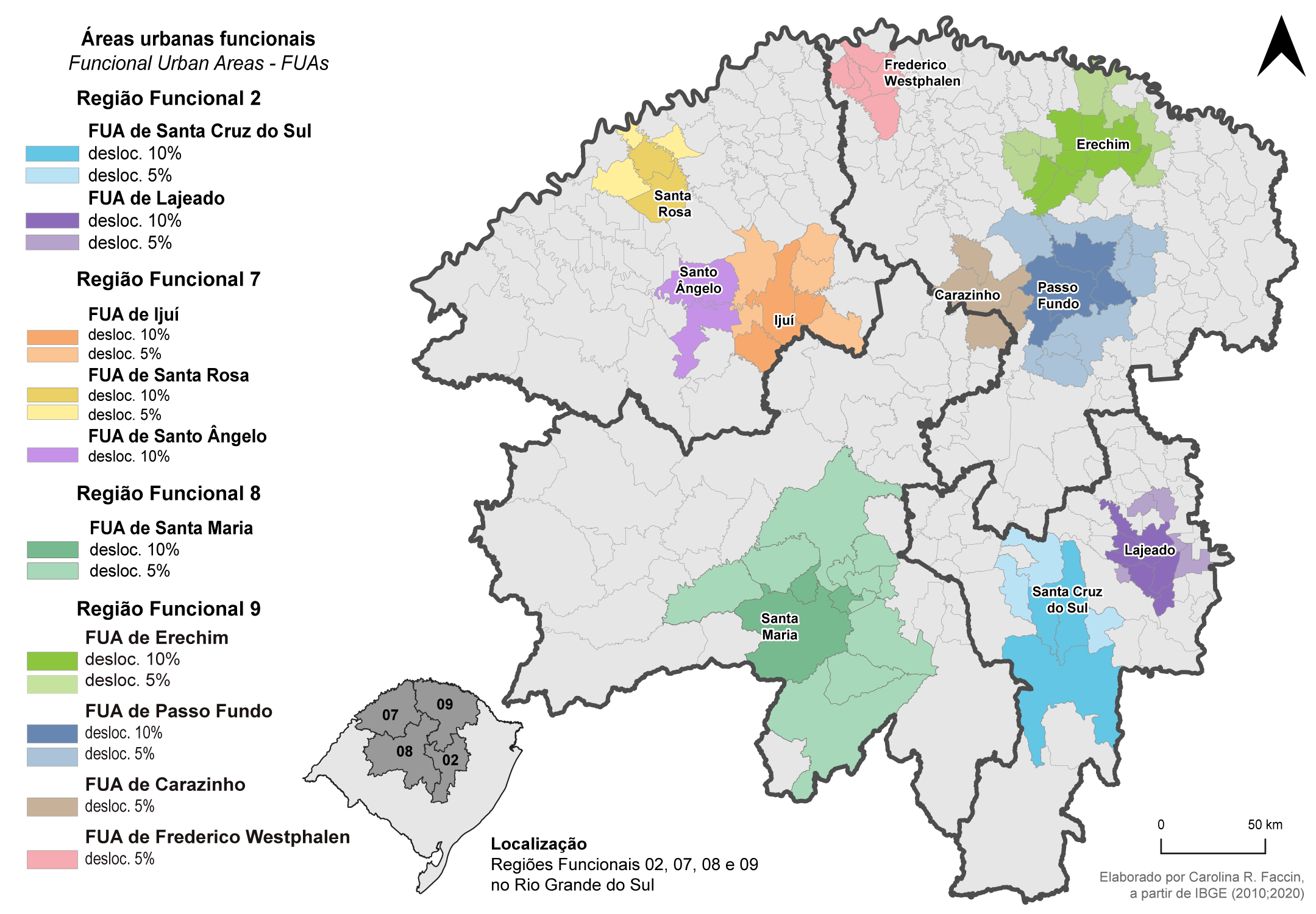
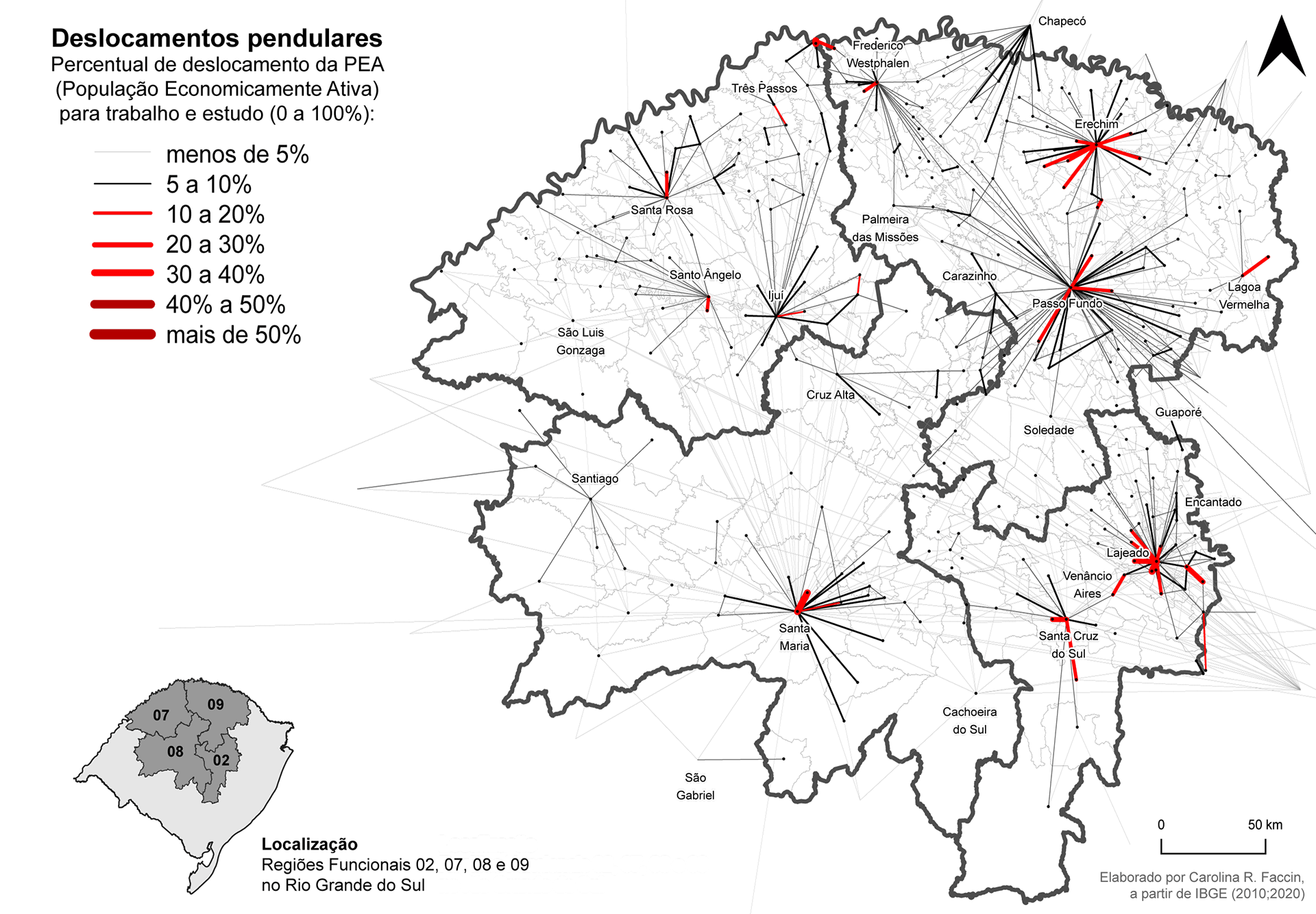
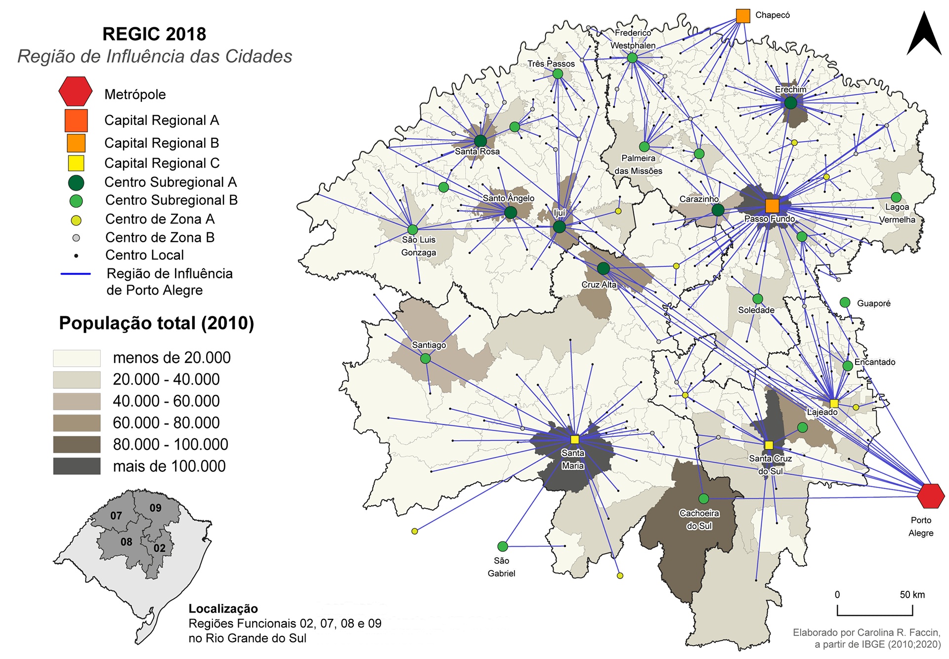
This was my main formative research experience: I joined as an undergraduate research assistant and stayed through my PhD. Across four planning regions, we combined official urban hierarchy data with commuting flows to delineate functional urban areas (FUAs).
- Hierarchy
Urban hierarchy and regions of influence (IBGE REGIC 2018)
- Commuting
Share of workers and students commuting between municipalities (Census 2010)
- FUAs
Municipalities above 5% and 10% commuting thresholds grouped around each center
- Synthesis
Comparison of four regions and the role of medium-sized cities
Results#
- Functional urban areas identified around Santa Cruz do Sul and Lajeado (Region 2), Ijuí, Santa Rosa and Santo Ângelo (Region 7), Santa Maria (Region 8), and Passo Fundo, Erechim, Carazinho and Frederico Westphalen (Region 9).
- An initial process of FUA formation, driven by commuting for work and study, with medium-sized cities as the anchors.
- A large body of work: two books, around ten articles and several chapters, forming a theoretical and methodological basis for later research and for public policy.
Why it matters#
Functional areas show where integrated planning, from public transport to health and education services, makes more sense than municipal boundaries. The method relies on open data and can be replicated in other regions.
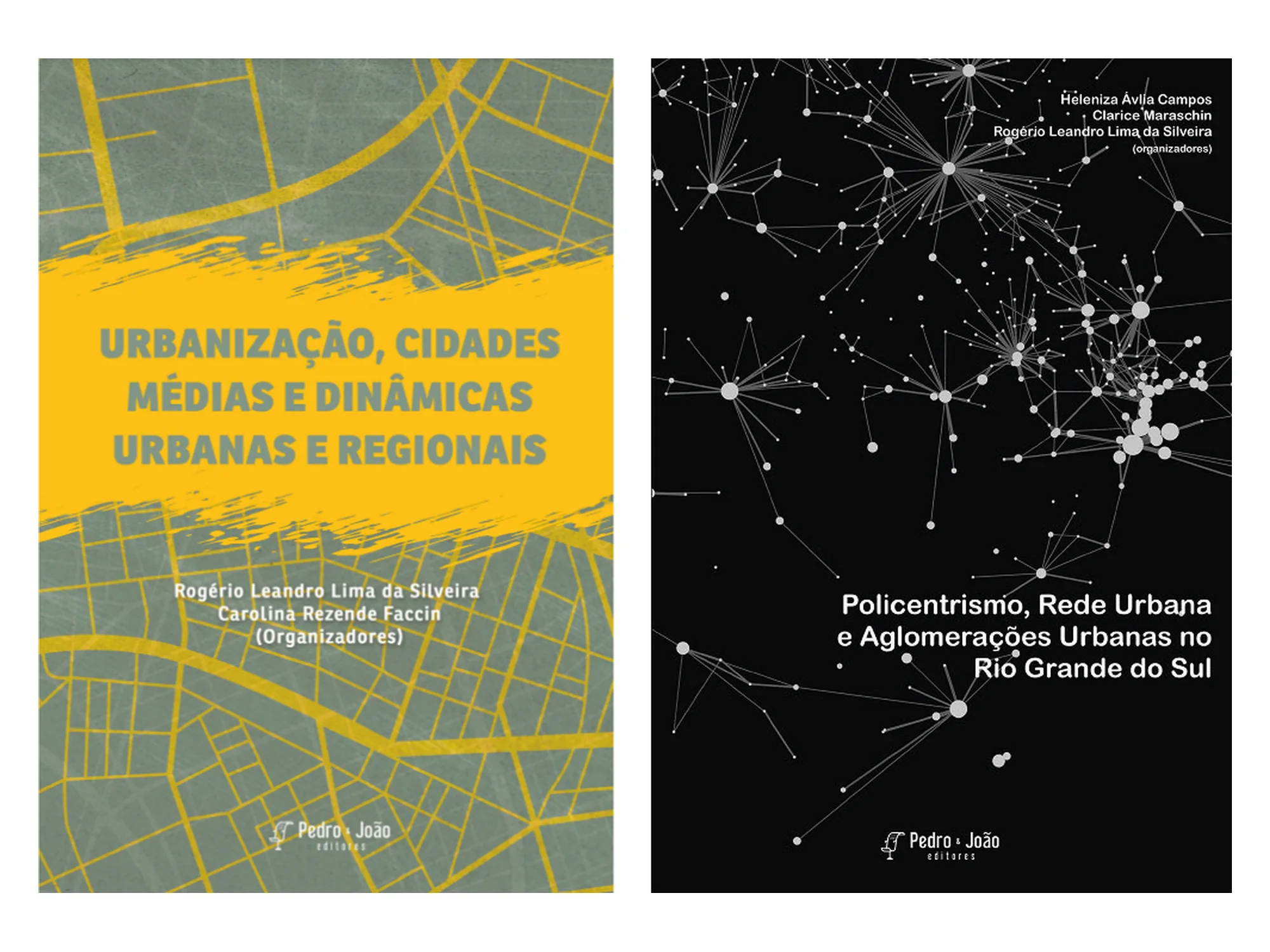
Books:
- Silveira & Faccin, eds. (2021): Urbanização, cidades médias e dinâmicas urbanas e regionais (co-editor).
- Campos, Maraschin & Silveira, eds. (2021): Policentrismo, rede urbana e aglomerações urbanas no Rio Grande do Sul (author of chapters 9–12).
Articles (PT):
- Silveira et al. (2017) and Silveira, Brandt & Faccin (2018): exploratory studies in the Rio Pardo Valley.
- Silveira et al. (2019a) and Silveira et al. (2019b): the Vales Region and the medium-sized cities of Santa Cruz do Sul and Lajeado.
- Silveira et al. (2020) and Silveira, Faccin & Krug (2021): the central region and Santa Maria.
- Silveira et al. (2022): the north-central region and its medium-sized cities.
- Silveira, Faccin, Silveira & Seibert (2022): intermediate cities and functional urban areas in Planning Region 7.
- Silveira, Faccin, Silveira & Seibert (2023): synthesis of the four regions.
Maps#